Sunday, September 21, 2014

Labyrinth Mountain

Well today's hike starting a little later than we had anticipated. We got to the trailhead and started hiking at 11:00 am (typically I like to be on my way down by this time of day, but it all worked out.) The four of us starting climbing the steep trail and quickly my legs could feel the pain of the previous days' climb of Mt. Mastiff. The trail is shaded as you hike up through the thick tree coverage gaining lots of elevation very quick: about 1500 feet in .8 miles. After the initial steepness, the trail's incline eases off a little bit as you exit the thick tree coverage and you climb the rest of the way to Minotaur Lake. The lake was beautiful with Labyrinth Mountain standing directly behind it, asking to be climbed.


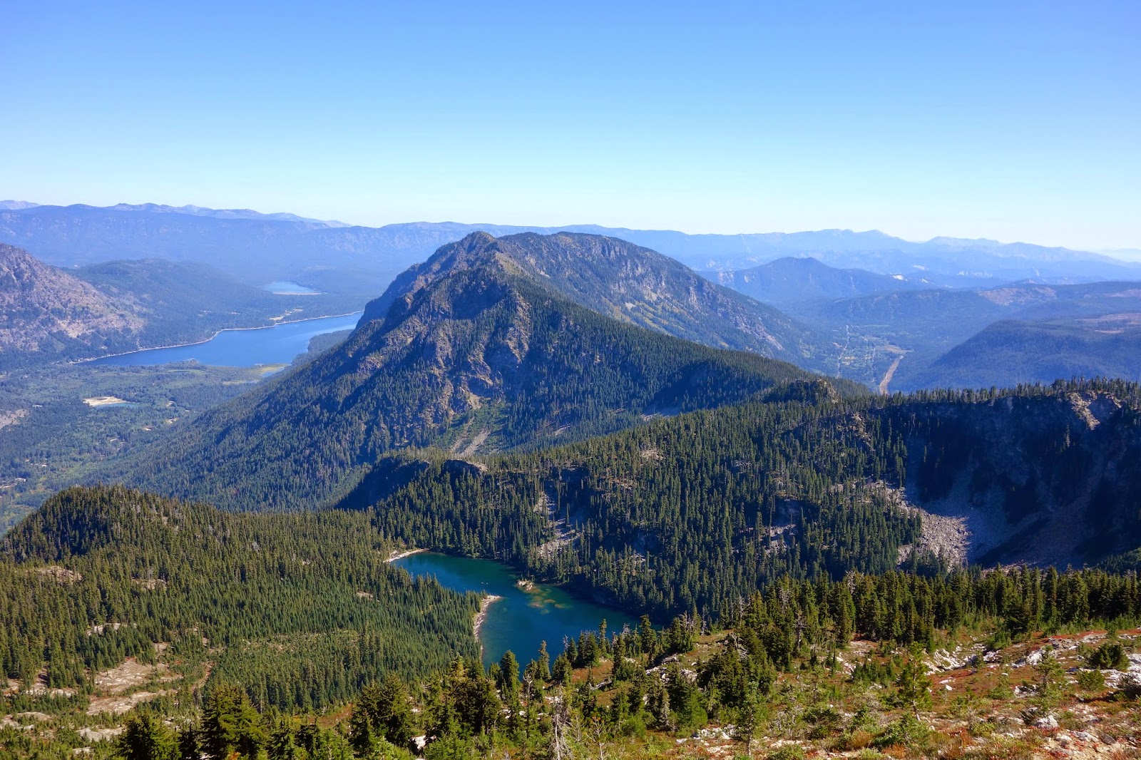
From the lake we made our way to the east side of the lake toward the ridge where you can look down upon Theseus Lake. We continued upward along the ridge toward Labyrinth. We made our way into some tree coverage again for a quick time and exited up onto some rock. From here there is a great view of Minotaur Lake which you just left. Very beautiful with the fall colors changing. We continued up following a faint boot path up to the peak of Labyrinth Mountain, there are several peaks and it may be hard to tell just by looking which is the actual highest point. But we determined it was the most east point that is the highest point, and that is where we found the summit registry and benchmark identifying Labyrinth Mountain.


At the peak we rested and ate some lunch, took in the views, signed the registry, relaxed and took some pictures. While we were at the peak a jet fighter flew right by us! It was flying low through the valleys and took a sharp banking turn right next to us, couldn't have been more than a few hundred yards away. It was really dang cool! After that excitement we made our way back down the mountain, on our way down we met a couple guys going up to Labyrinth and we tried pointing the route we took to help them out, but as we looked back a few minutes later they had gone to the wrong peak. Don't know if they every made it to the true peak. But I'm sure they had great views nonetheless.


We made our way back down rather quickly and were able to get done and home at a really reasonable hour considering how late we got started. I will be honest, at the start of the day I was not in the best mood and wasn't too excited about climbing today due to sore legs, a wicked headache and the lateness of the start that we had. But I'm definitely glad I did end up going, my headache went away, it was an absolutely beautiful day, the views were amazing and I had great company once again. Certainly a worthwhile trip. Good times once again (I've found its hard to have a miserable day in the mountains.)


Region: Central Cascades, Stevens Pass East
Distance: 5 miles
Elevation Gain: 2800 ft
Peak Elevation: 6350 ft
Difficulty: S2, T1
Pass Requirement: Yes, Northwest Forest Pass

As always check out all the photos of the hike and every hike by clicking on the "Photos" tab.

Saturday, September 20, 2014

Mount Mastiff


This morning I woke up early and got ready to head to the mountains. I met a group of fellow Mountaineers at the trail head of Merritt Lake over passed Stevens Pass about 8:30 am and got going up the trail at about 9:00. It was an absolute beautiful morning. So we started off and followed the switch back trail gaining about 1800 feet of elevation before you come to a junction in the trail at about 4820 ft, one continues on north to Merritt Lake the other heads south. We took the one heading south, which switchbacks some more and becomes less maintained. There was an area here with lots of downed trees and the trail becomes hard to follow and we eventually lost the trail. After some short discussion amongst the group we determined our direction of travel and quickly found the trail again. We continued on this trail until about 5400 ft and then followed a climbers trail up the ridge. Along the ridge were some excellent views of the valley and surrounding mountains.


As we continued up the ridge enjoying the views and the beautiful mountain ash changing color, we caught glimpse of Lost Lake which was quite the sight. There were a handful of people on rafts floating around the lake. About this time, we took a rest, ate some food, hydrated ourselves and enjoyed the views. Then we donned our helmets and got ready for some rock scramble, we descended a couple hundred feet or so from the ridge (which wasn't very passable) and scrambled toward a more accessible route up the rest of the mountain. We then ascended up a boulder field and eventually made our way all the way to the top of Mount Mastiff. Here the views were astounding, views of Glacier Peak, Labyrinth Mountain (a bit of foreshadowing there, since this is were I would be going the next day) Lake Wenatchee and more were our backdrops.


At the top we rested for a bit, ate lunch, took pictures and signed the summit registry. Some of us even took a quick nap (okay that was me.) It was such a beautiful day with blue skies all around us, but there was quite a lot of wind at the peak, so it was a bit chilly. But after a good time at the top we made our descent down the mountain. On our way down I used trekking poles for the very first time. I have used them before while snowshoeing, but I've never used them on a trail just on a hike or scramble before. Lots of people were telling me how much they liked them and they saved their knees. I think I liked them and may use them more often. But we made our way down safely, no injuries other than sore muscles and sore feet. It was a great trip with lots of beautiful views with a good group.


Region: Central Cascades, Stevens Pass East
Distance: 10 miles
Elevation Gain: 3800 ft.
Peak Elevation: 6700 ft.
Difficulty: S3, T3
Pass Requirement: Yes, Northwest Forest Pass.

As always check out all the photos of the hike and every hike by clicking on the "Photos" tab.